Ystadegau LTT yn ôl cod post
– Testun cymraeg i’w ychwanegu –
Nodiadau wythnosol
Bob wythnos rydym yn rhannu diweddariad byr ar yr hyn rydym yn ei ddysgu, ynghyd â dolenni i bethau sydd, yn ein barn ni, yn ddiddorol neu'n berthnasol.
Blog
- Pam fod anghywirdebau’n llithro i gyfeiriadau ar ffurflen y Dreth Trafodiadau Tir?
- Sut gall map baentio darlun ehangach
- Crynhoi'r Prawf o Gysyniad
- Beth ddysgon ni o anghenion ein defnyddwyr?
- Sut y gwnaethom ni ddefnyddio nodiadau wythnosol
- Beth rydym wedi ei ddysgu o weithio’n agored
- Beth yw llwyfan data?
- Croeso
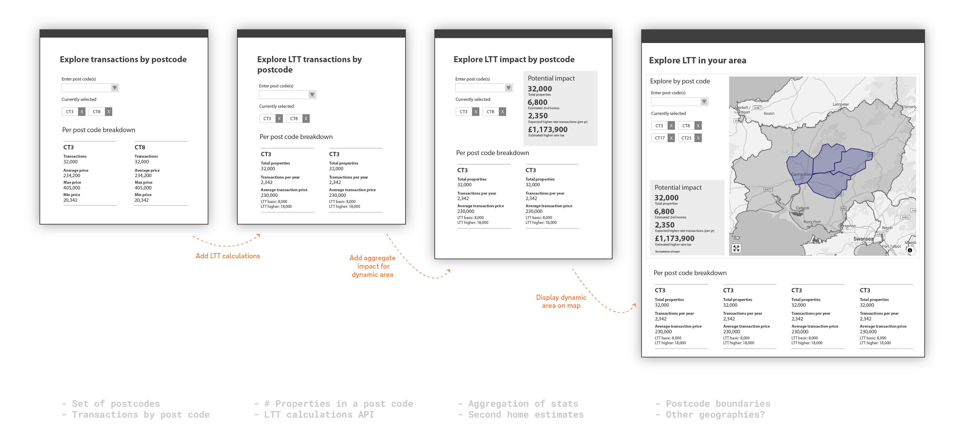
Prototeip
Fe wnaethom adeiladu nifer o brototeipiau i brofi ein rhagdybiaethau, gallu platfform a syniadau.