Blog
Summarising the Proof of Concept
Anthony Pritchard, Richard Pope, 26 May 2022
This is a summary of the work we presented at the week 12 showcase for the land and property data platform proof of concept.
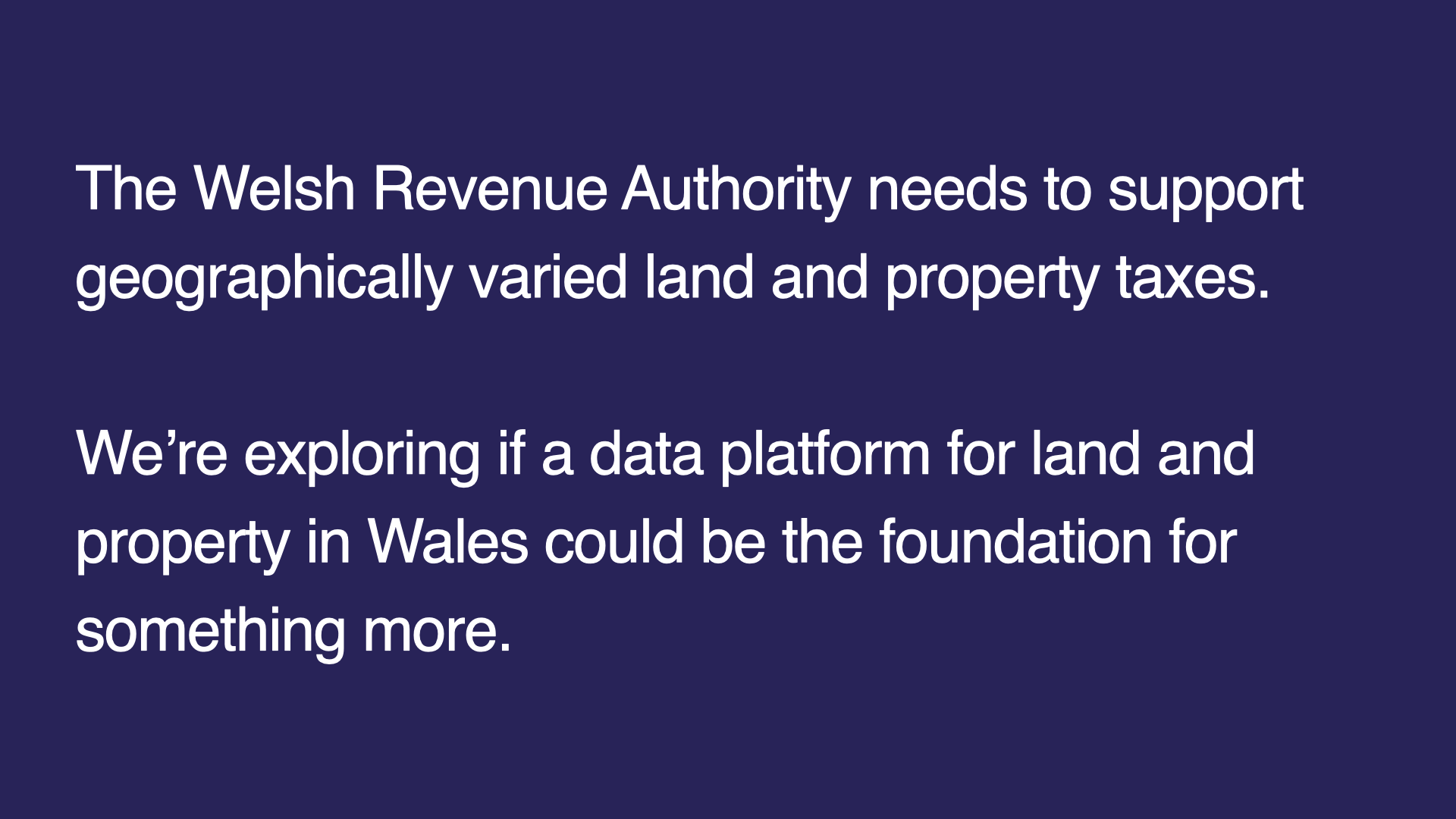
It’s an exciting time for devolved taxation in Wales. The Welsh Revenue Authority will likely need to support geographically varied land and property taxes. There’s also work on Council Tax reform and early discussions about a Tourism Levy.
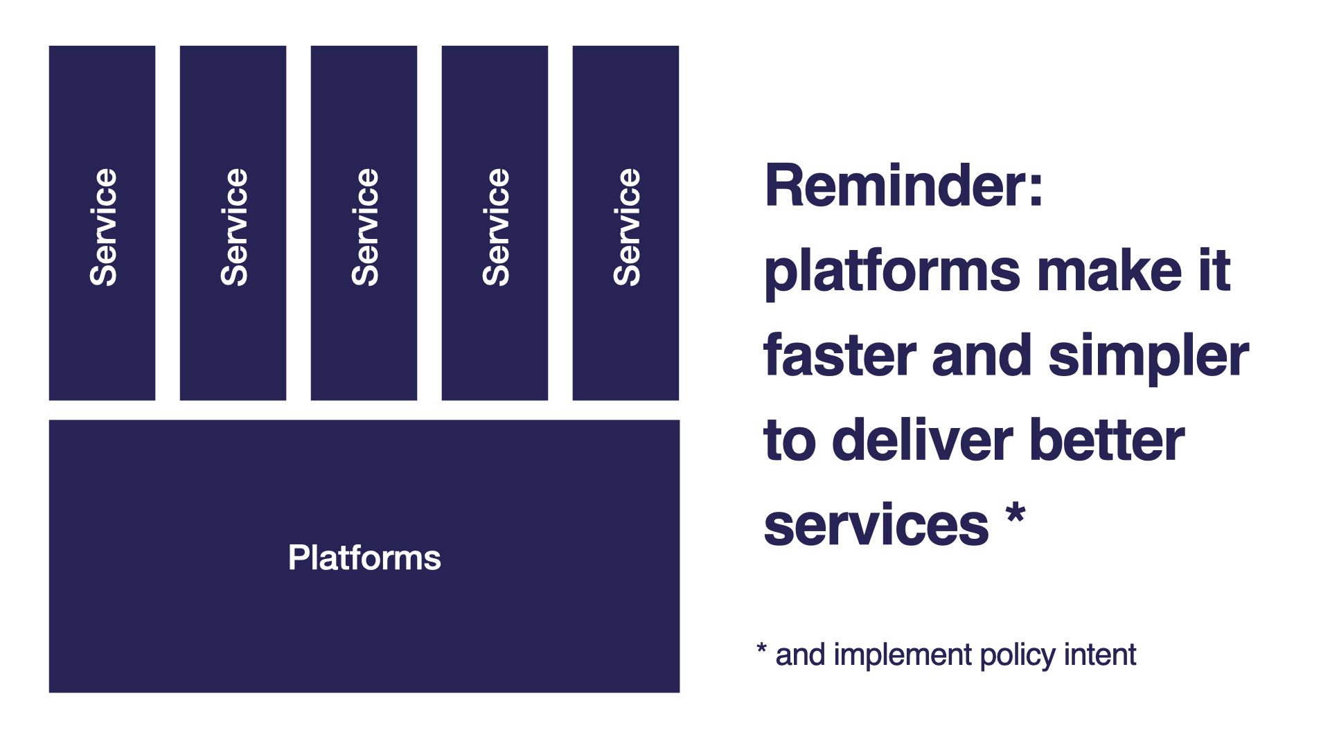
We wanted to learn how the WRA can support geographically varied taxes and, by taking a platform approach and ‘learning by making’, start to understand whether this could also be the foundation for something for all of Wales. A reminder that when we talk about ‘platforms’, we mean things that make it simpler and faster to deliver public-facing services and deliver on policy intent.
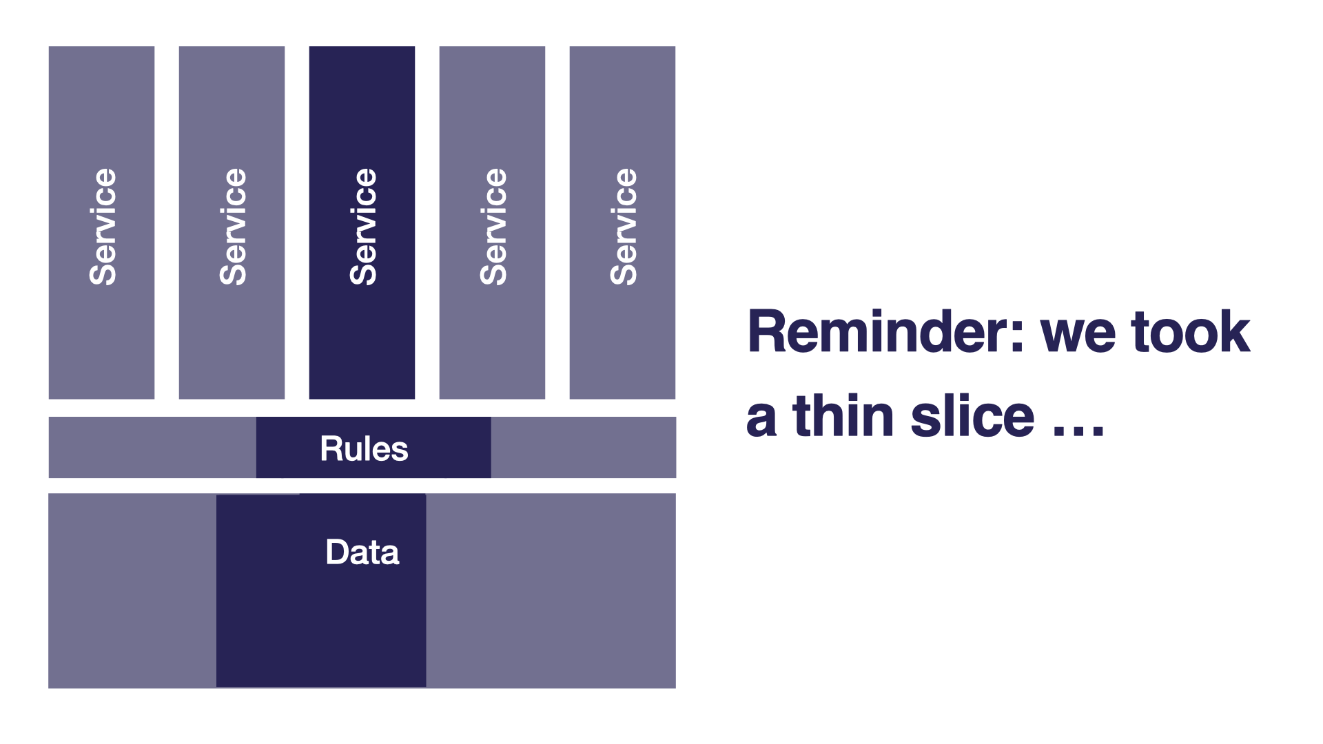
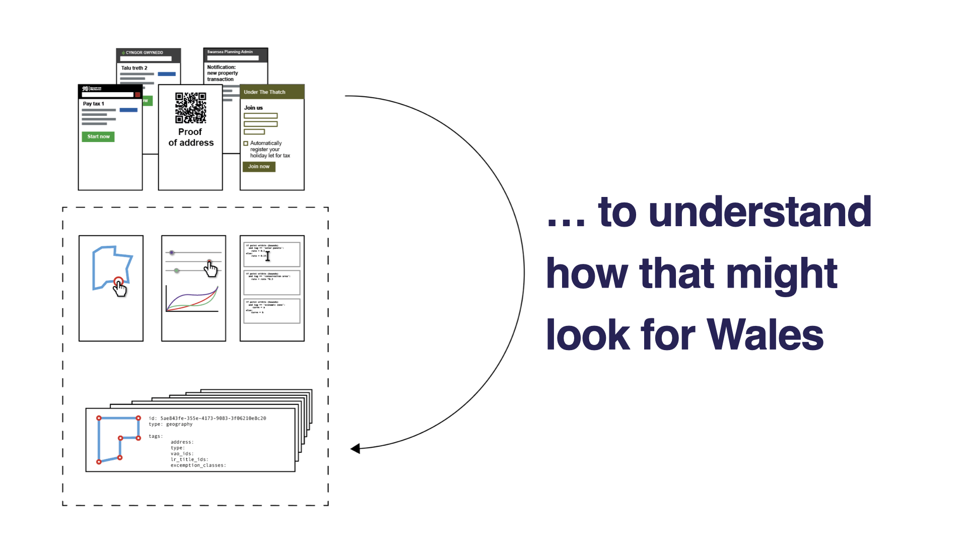
And that our approach was to look at thin slices of functionality and data to help us explore the opportunities and challenges of a land and property data platform to understand how that might look for Wales.
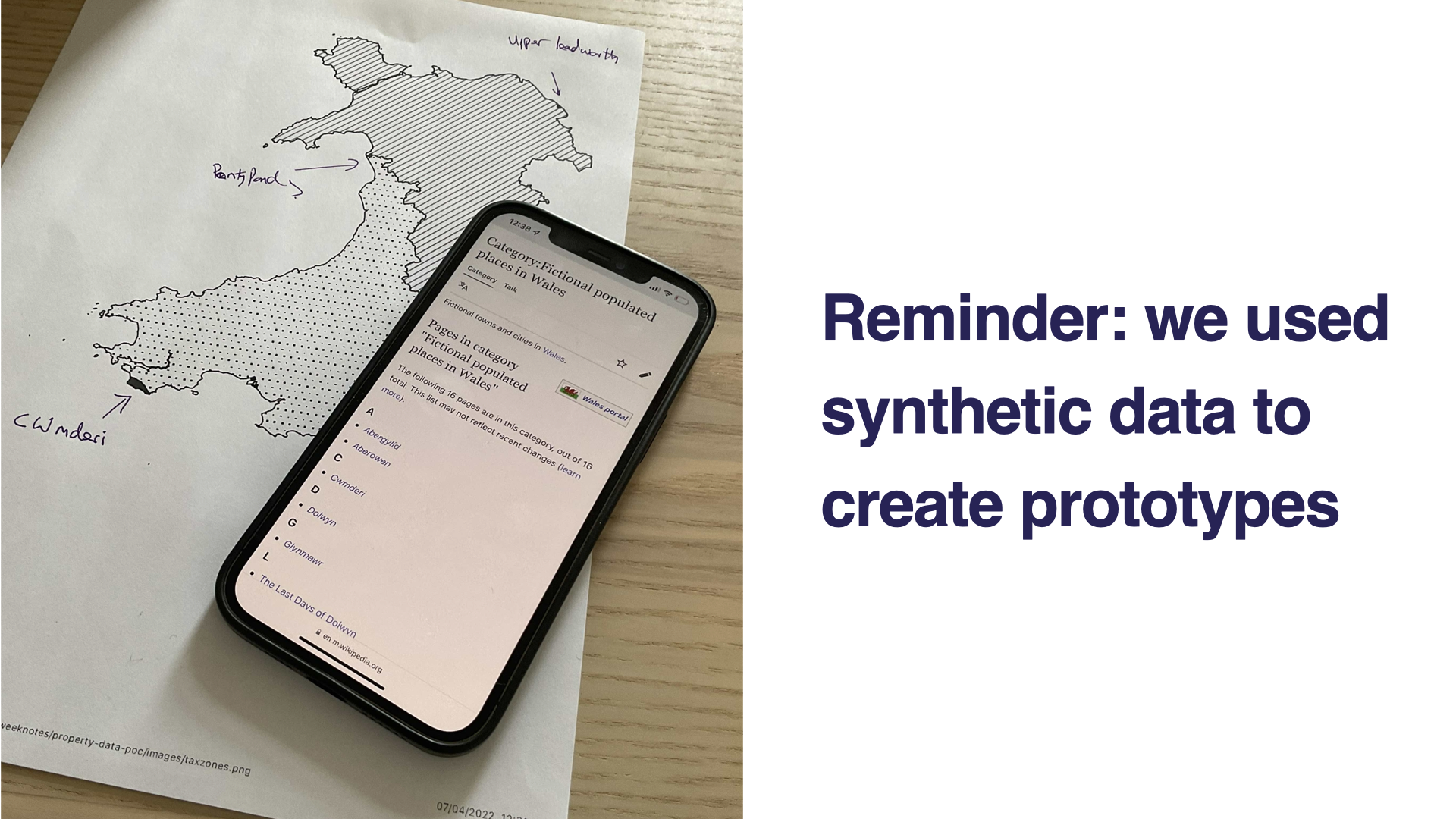
Finally, a reminder that our work is speculative and all the data we used was synthetic. Place names, and locations were inspired by a Wikipedia entry and sited on military/ex-military land. We also made up two ‘tax zones’ (North East and South West) to illustrate the idea of locally varied taxes. Again these were fictional - we didn’t want to set any hares racing during the proof of concept!
We set ourselves 4 objectives to meet within 12 weeks, which we’ll step through with examples of work we’ve done and things we’ve learned.
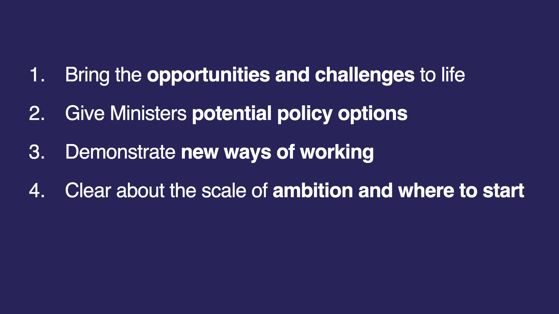
1. Bringing the opportunities and challenges to life
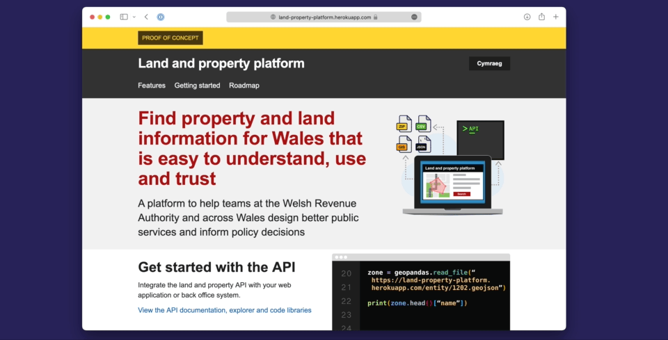
We built a platform prototype using synthetic data. It’s working code, but a small-scale model of the real thing. It’s helped us think about how a data platform for land and property might work in reality.
We know that good platforms do a few simple things well. Through research, we learned that making these clear to any potential users is vital.
For example, we listed its features and tried to explain how they help users solve their problems:
- Verify whether a property is in Wales. Less straightforward than it sounds.
- Provide tax rates for an imagined local Land Transaction Tax
- And look up any property in Wales based on a Unique Property Reference Number (UPRN)
We know that potential users will want to have a poke around and play before they get started so we’ve added documentation and a way to explore APIs.
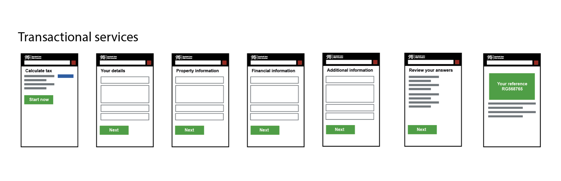
To test the platform, we built a really simple service on top of it called Is It In Wales? You’ve guessed it: it tells you whether a property is In, Not In or Partially in Wales.
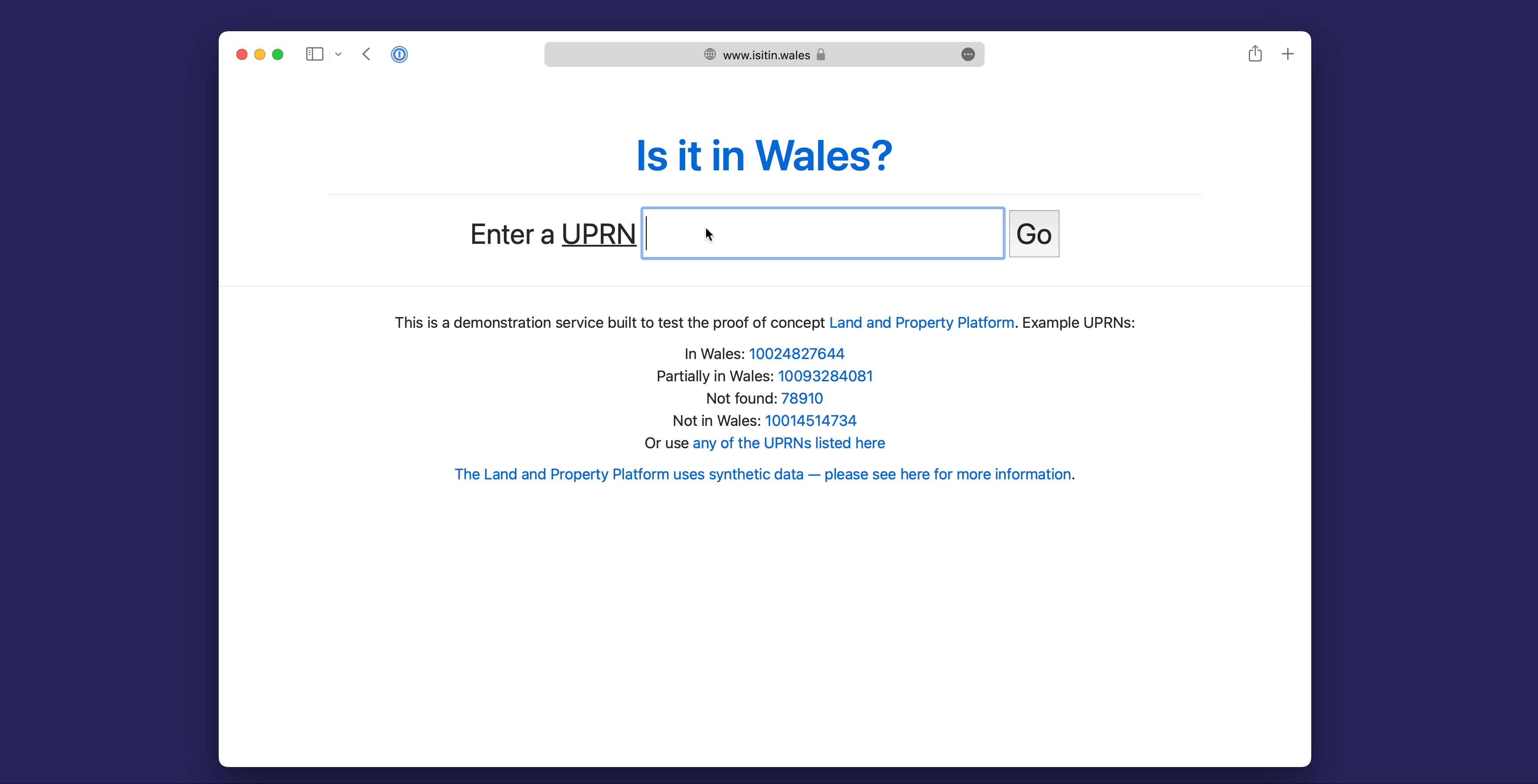
It sounds so simple, but actually due the ambiguity and complexity of different datasets that currently exist, there’s not always a simple answer to this question. The platform makes answering it trivial.
Using a platform to surface information at different stages throughout the buying process
Platforms enable multiple services, so we wanted to think through how information might be surfaced at different stages of someone buying a property.
One scenario we explored was how property search engines, like Rightmove, might present geographically varied taxes. How would that look and feel to a home buyer? Could we explain localised land and property taxes in ways that people understand?
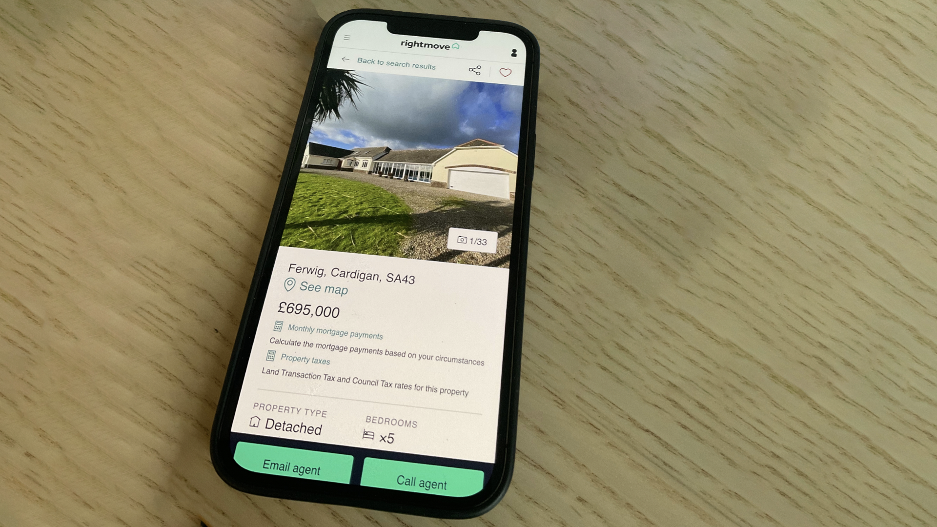
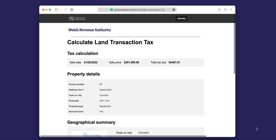
How would it feel when people were switching mode from searching for a house to actually buying it? This is a mocked up a tax calculator to illustrate how that might work.
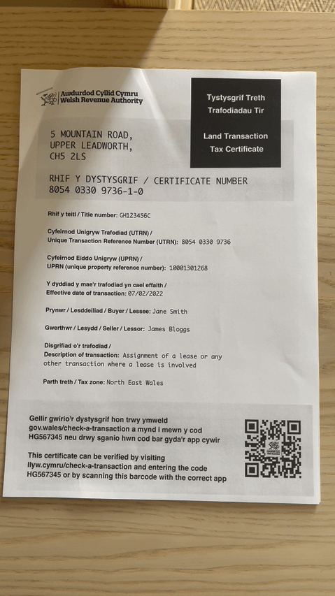
Finally, we wanted to explore the idea of creating a digital proof of transaction. A land and property platform might be the first place that a transfer of ownership is recorded. Could that become a jumping off point for future joined-up services?
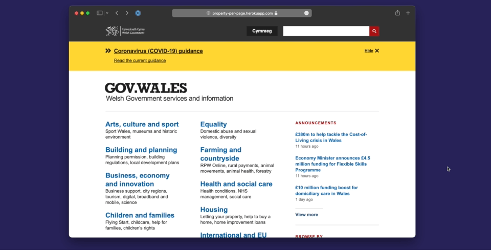
Property-per-page
Imagine being able to type in a postcode on GOV.WALES and being able to see information about that property and its locale - a bit like Google search does for maps. It could form the launchpad to national and local services as well as lots of other useful information.
A property data platform would make this simple to deliver and low cost to maintain.
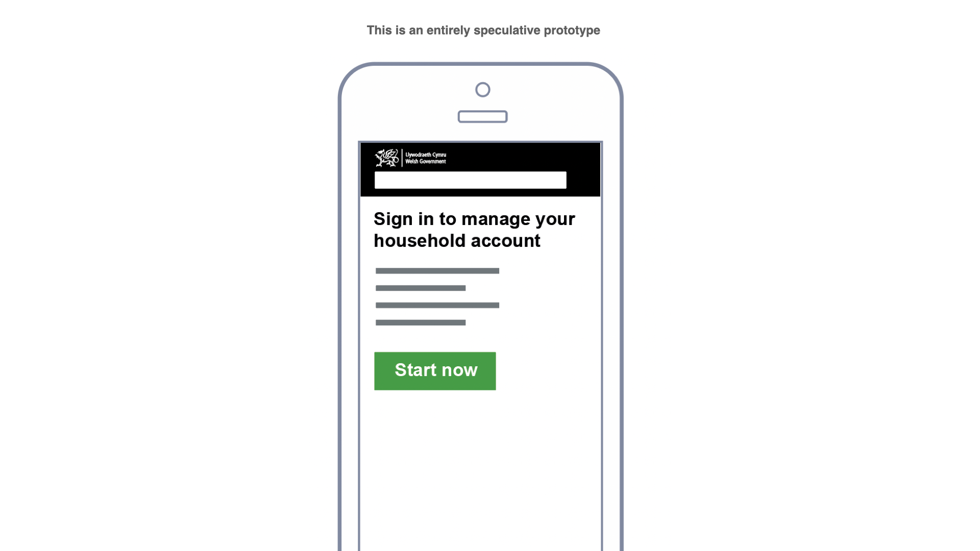
All these examples are speculative prototypes. They aim to show the range of services that could be supported by a platform and some of the opportunities it might open up.
2. Giving Ministers potential policy options
There’s been a lot of discussions within the Welsh government about what devolved taxes look like in the future. One of our objectives was to explore the potential policy options that a land and property platform might make possible and how it might support the devolved tax framework that underpins it.
A common platform for land and property data in Wales means that new types of services and previously impossible (or at least difficult) policy options can be made a reality.
New paradigms for the design of services
Taking service design first, the archetypal government digital service generally looks something like this:
Typically you might enter some data on a web form, submit it and then wait for something to happen. In the meantime you might get an email confirmation and you’ll be able to check progress. In this scenario people are expected to enter information that they might have already told the government about; plus they have to wait for something to happen.
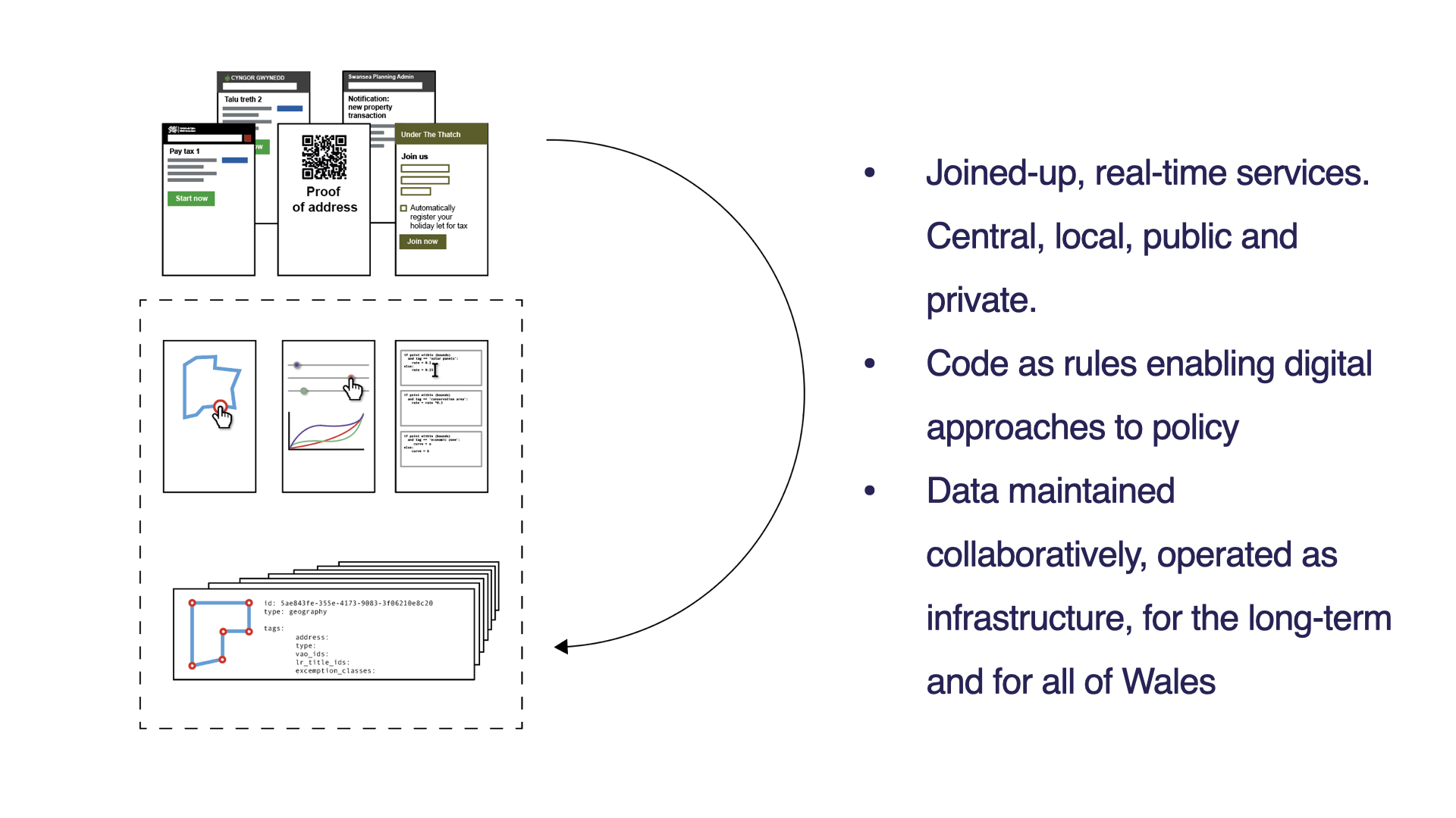
Platforms offer the potential to offer more real-time services that reduce this administrative burden and save time. Maybe like this, where information that is already held can (with appropriate oversight and permission) be reused:
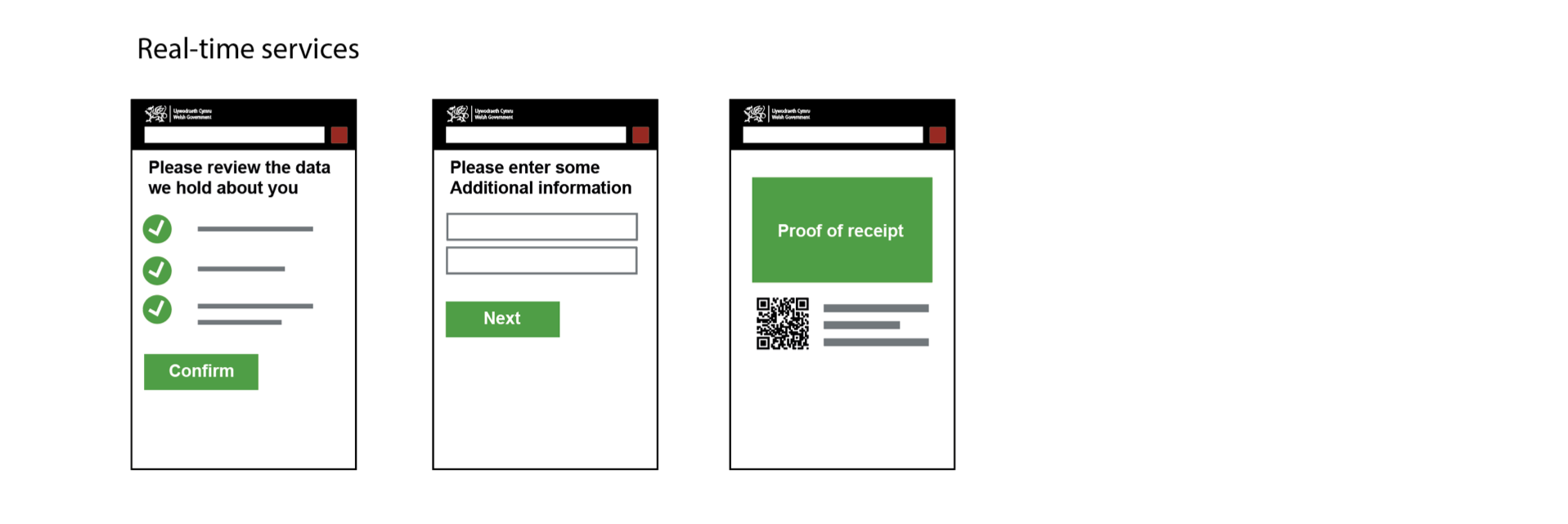
Bringing together information from across government into a single service:
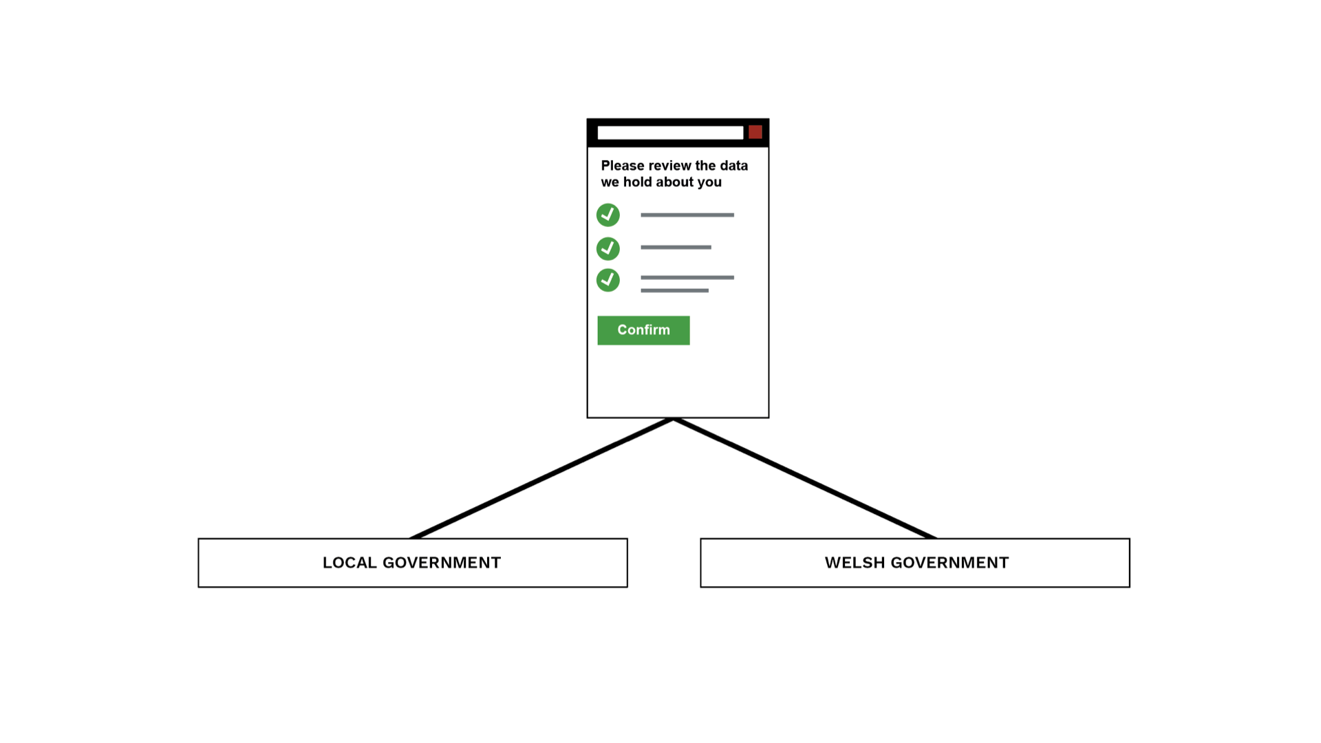
or helping people to interact with the Welsh Government and local authorities at the same time:
One of the areas we’ve discussed during the proof of concept is the potential to support a Tourism Levy where accommodation businesses in Wales register themselves to collect a tourist levy. This could be supported by a land and property platform that draws together information from different bits of government, or supports private sector organisations (e.g. Airbnb) with the appropriate permissions to safely use some of this data too.
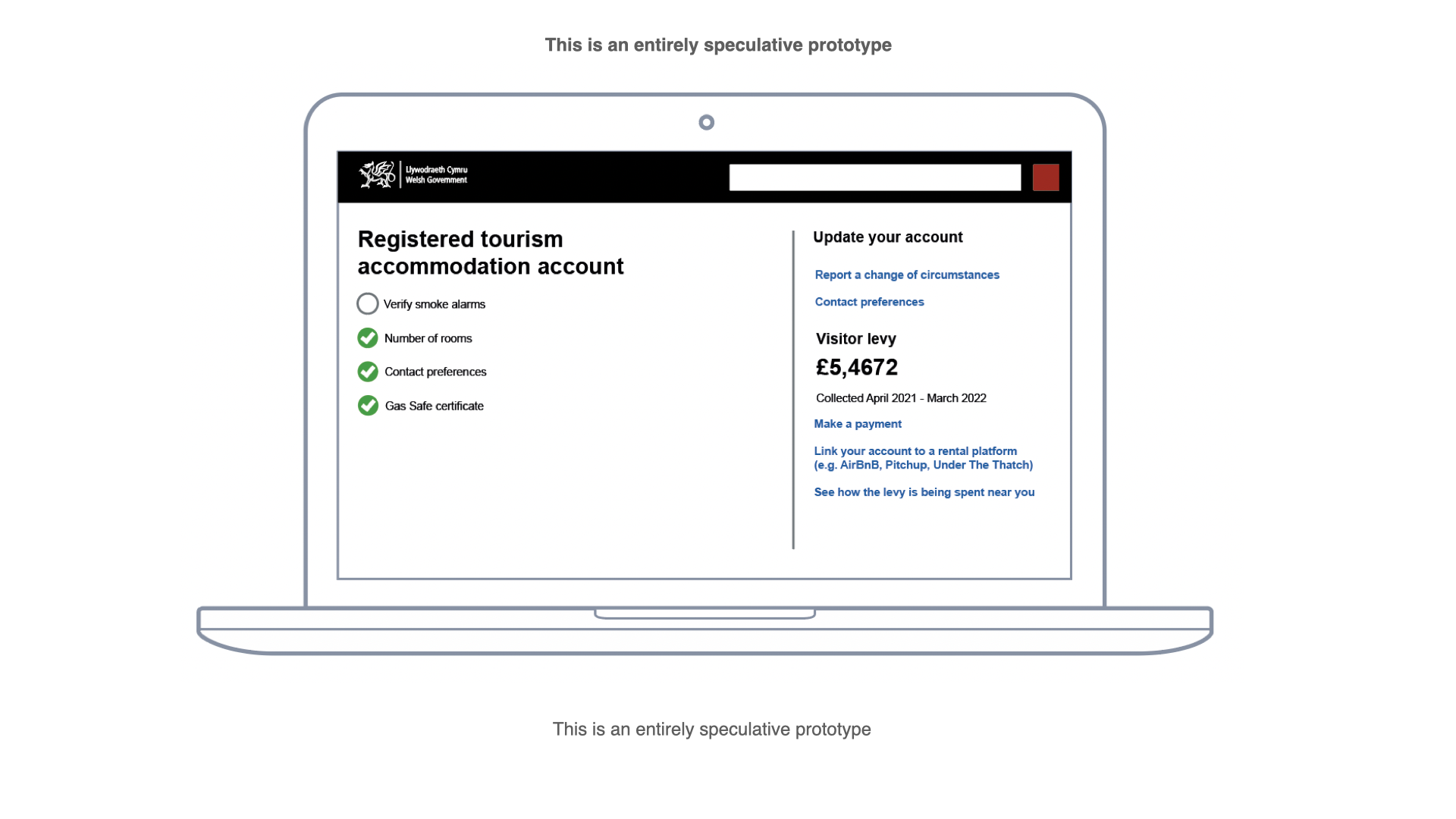
Or imagine how having a shared, common identifier for tourism business to surface the impact of policies. Here is an entirely speculative mock-up of a door sticker that would allow people to scan a QR-code to see how the Tourism Levy is being spent in the local area.

These examples are not attempting to provide the answer - that comes from incremental delivery and research. Hopefully they do point to some of the things that might become simpler with a common platform.
New policy tools
The land and property platform could enable new ways of designing and testing policy. We experimented with a tool called Jupyter Notebook to explore how we might implement ‘policy as code’.
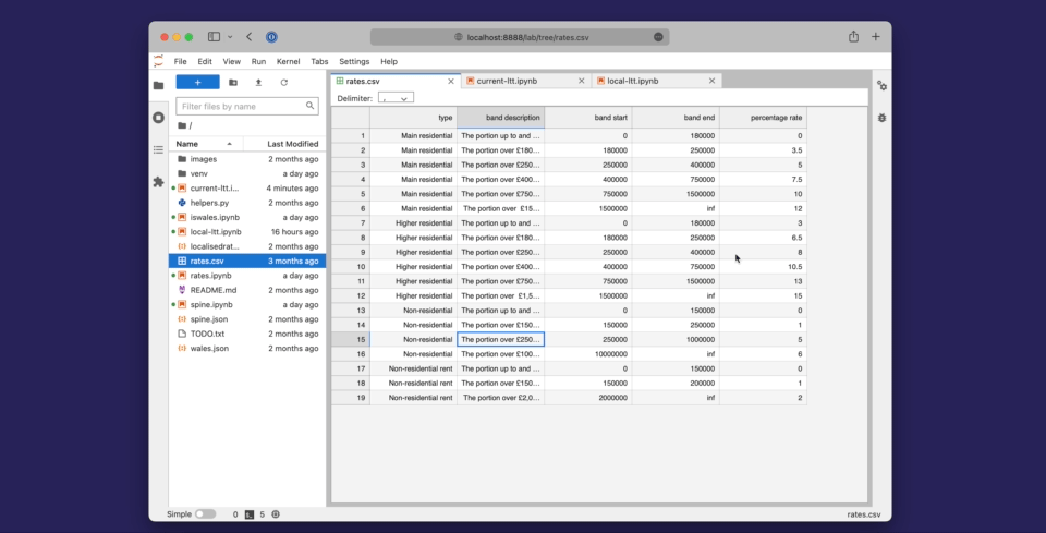
The idea of codifying policy as a combination of text and code means that it is understandable by humans and computers. It has the potential to allow policymakers to test the impact of their policy design.
During the proof of concept we use it to test the ideas of ‘Local Land Transaction Tax’ by working up a number of examples and modelling fictional geographical boundaries.
New policy levers
What kind of policy levers would a digital-first approach enable? We’ve described these as ‘policy patterns’ - a list of types of policy options a platform could make possible. We’ve been using these to help us develop some shared language between policy and digital specialists.
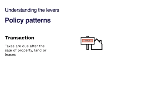
For example, a property and land data platform could enable:
-
Tax zones are based on any area you could draw on a map: postcode, Local Authority, a National park, 10 miles from the sea.
-
Market context: link tax rates to other data sets like the prevalence of second homes. That would be very hard to do in an analogue system.
-
Taper rate would give policymakers great levels of control over the variance of tax to them fairer
-
Physical attributes of land and property, like solar panels, could be added to the platform and used as a basis for taxation. Over time, more data that is added to the platform will open up more policy options
3. Showing new ways of working
We set ourselves the objective of demonstrating new ways of working. For the 12-weeks of the proof of concept the team worked in weekly (‘agile’) sprints and committed themselves to working in the open to share progress as we went.
Working in the open
Early on we created a team website which we used to share progress through weeknotes and thinking-out-loud blog posts. These were an effective way of explaining what we’re doing to people outside of our team and organisation. We believe they’ve improved how we communicate and collaborate and see loads of benefits of working in the open.
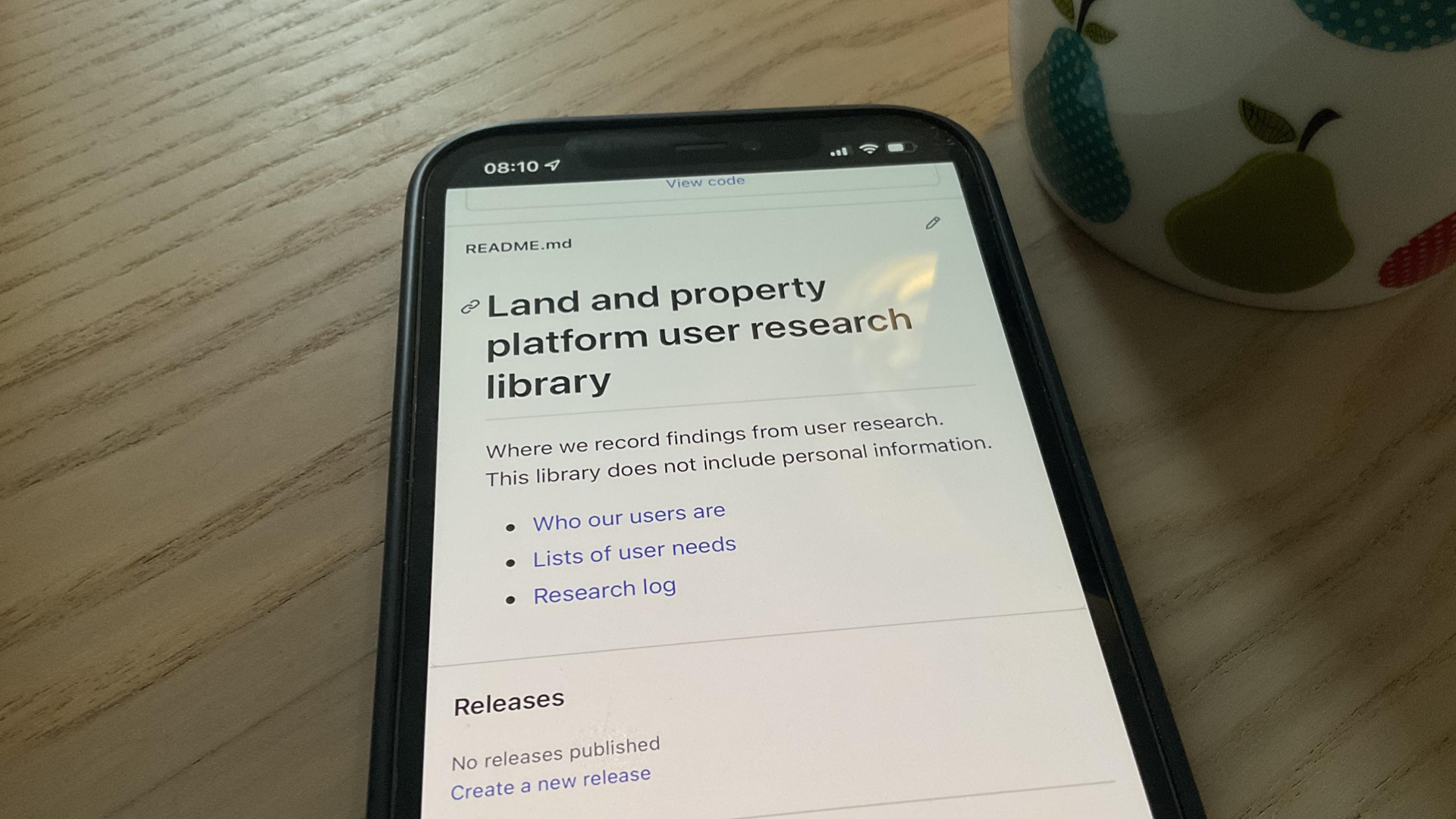
Github is our documentation
We’ve used Github as our documentation. For example, what we learned about the Welsh land and property data landscape is available for everyone to see and amend. It’s built on other people’s great work that they’ve shared in the open.
Show & Tells
We’ve used Show & Tells to people inside and outside of the WRA interested in the project up to date. They form an important part of our governance.
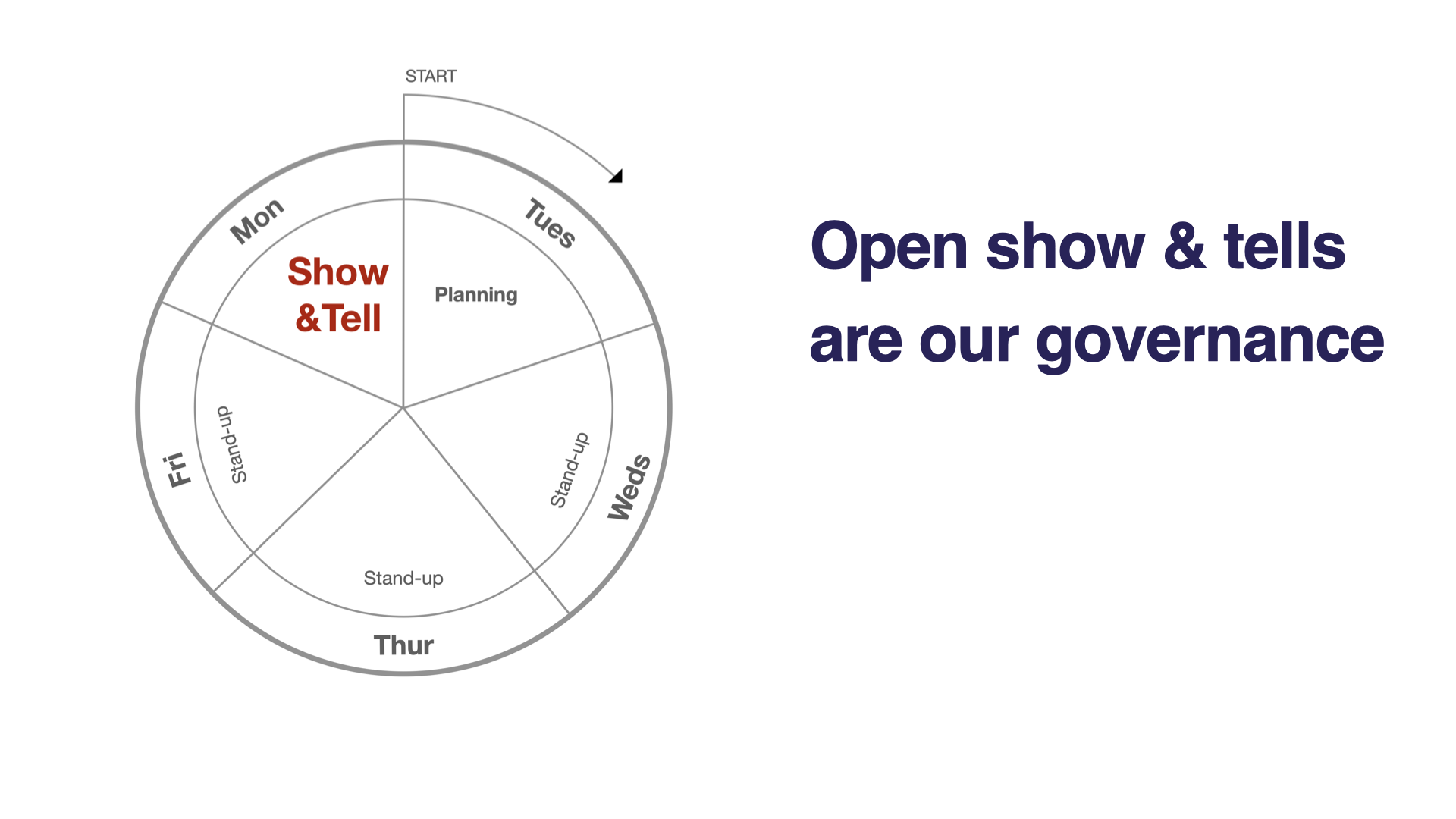
For 30 minutes every Monday, the team demonstrates progress (work done, things learned) to attendees. It gives stakeholders, collaborators, and experts in the field a chance to ask questions and challenge the team.
The forum provides independent scrutiny and hopefully builds confidence and trust in the team. It lets sponsors assess whether the team is delivering value.
Show & Tells help ensure the team is delivering the right thing in the right way by turning governance into ongoing engagement.
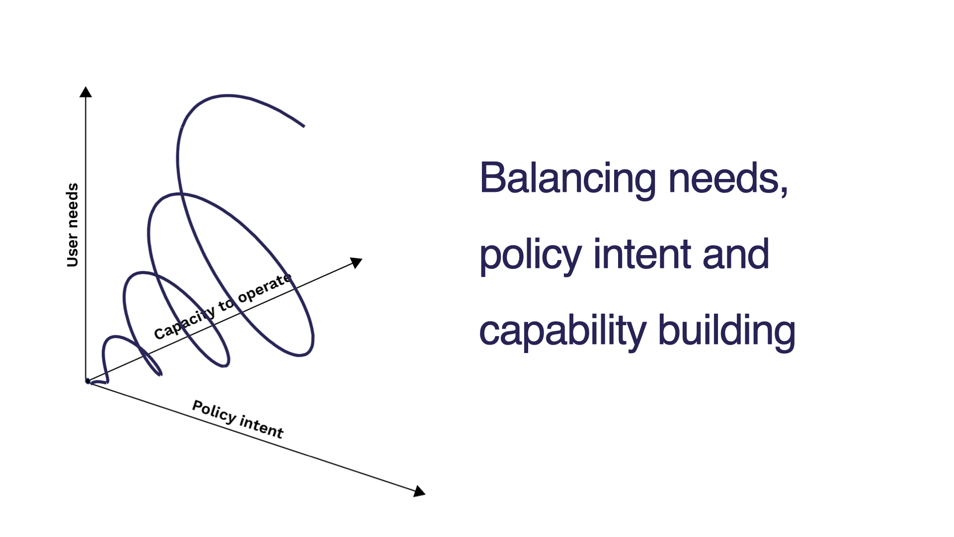
Incremental delivery approach
Each week the team needs to balance the trade-offs between learning, meeting the needs of users, delivering policy intent and building organisational capability. By delivering in small increments the team aims to deliver something of potential value each week.
4. The scale of ambition and where to start
The final aim of the proof of concept was to be clearer about the scale of ambition and where to start. Based on what we learned, this is our proposed, high-level approach to how we grow capability:
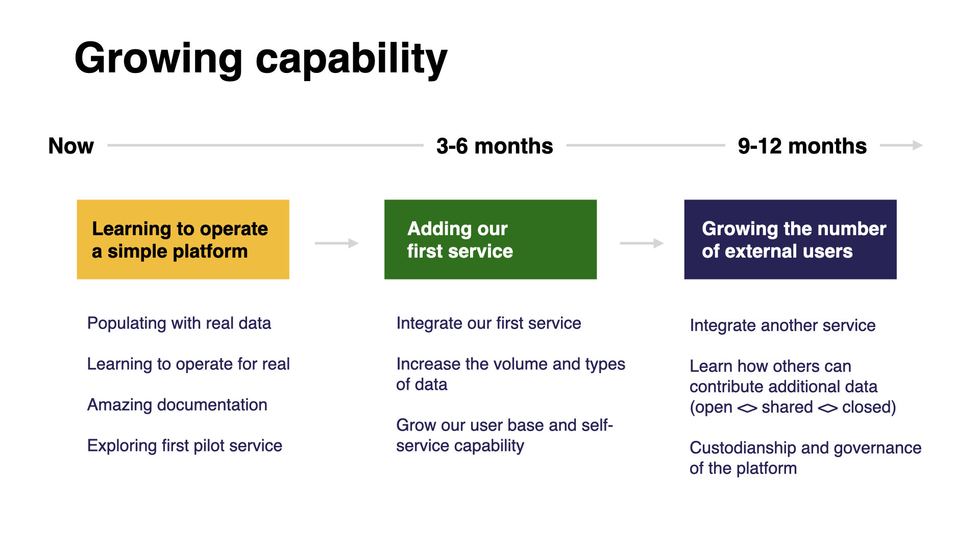
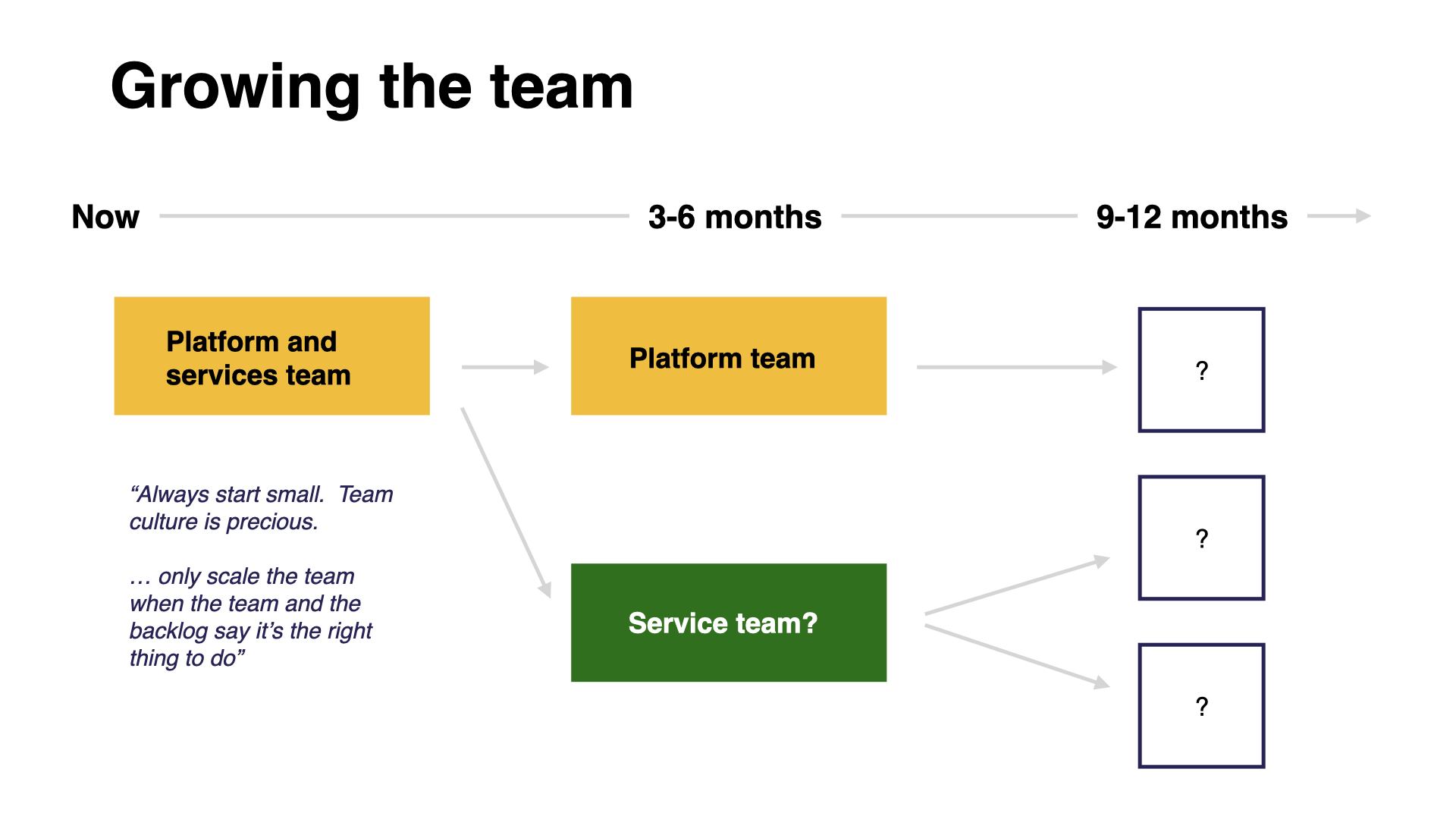
The timings are speculative but illustrate that this is just the start of something.
Start small, aim big
The ambition for the land and property platform is not about a single policy or initiative. It’s for the long term. It’s for Wales. A land and property data platform could mean better policy outcomes and a different approach to how public services can be designed.
If you have questions or want to hear more about this work then feel free to get in touch
Weeknotes
Each week we share a short update on what we’re learning, along with links to things we think are interesting or relevant.
Blog
- The technical architecture
- Policy challenges
- Every day's a school day – lessons learned from the land and property platform
- Why are inaccuracies creeping into addresses on the Land Transaction Tax return?
- How a map can paint a bigger picture
- Summarising the Proof of Concept
- What we learned about users
- How we used weeknotes
- What we've learned about working in the open
- What do we mean by a data platform?
- Welcome
Prototype
We built a number of prototypes to test our assumptions, platform capability and ideas.