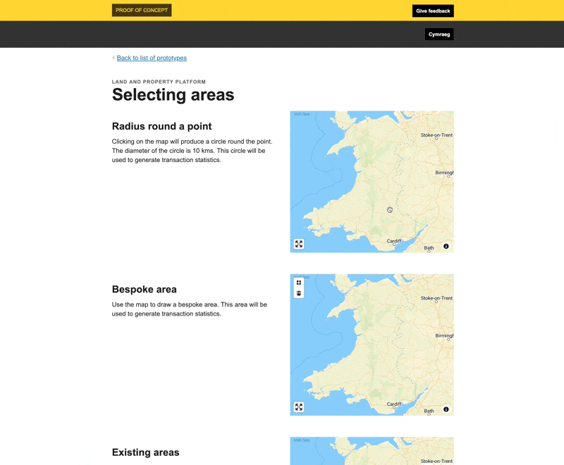
Ways to construct areas
For geographically varied policies a key need is defining the geography or area the policy will apply to.
There are many ways to do this, whether you are starting with a point, a pre-existing geometry or planning on defining your own bespoke one. The policy pattern work from phase 1 explains a few of the approaches.
This prototype tests out a few interaction patterns for how areas could be defined.
Showing them within the same prototype means it is easier to assess their differences and explore the nuances that need to be considered if using.
What we learnt
Radius round a point needs to be an editable option. Will there be multiple points or one? How will you handle cross overs?
As previously mentioned Drawing areas has usability challenges.
Using pre-existing areas comes with its own challenges. Firstly, they were created for a specific purpose, meaning their granularity and characteristics might not suit the purpose of the new policy. For example, a local authority can include a wide range of different types of neighbourhood and you’d only want certain policies to apply to certain neighbourhoods.
Another thing to consider is that pre-existing areas change over time, how will the policy handle this? Will it be tied to a snapshot of the given area or will it adapt as the area changes? E.g. the boundaries of where the new policy applies changes along with the electoral wards…
Issues to resolve
The platform functionality that lets us select pre-existing areas currently only works with geometries that are Polygons. A lot of the pre-existing areas are multi-polygons so we will need to extend the platform functionality to handle these.
Weeknotes
Each week we share a short update on what we’re learning, along with links to things we think are interesting or relevant.
Blog
- The technical architecture
- Policy challenges
- Every day's a school day – lessons learned from the land and property platform
- Why are inaccuracies creeping into addresses on the Land Transaction Tax return?
- How a map can paint a bigger picture
- Summarising the Proof of Concept
- What we learned about users
- How we used weeknotes
- What we've learned about working in the open
- What do we mean by a data platform?
- Welcome
Prototype
We built a number of prototypes to test our assumptions, platform capability and ideas.