Explore land and property data
This prototype aimed to explore two things.
Firstly, the extra open geospatial datasets we’d added to the platform meant we could test using multiple large datasets in one “service”. This would give us an idea of what issues service builders might face and how the platform might be able to help when things scale up.
And secondly, we wanted to try out some potential interaction patterns.
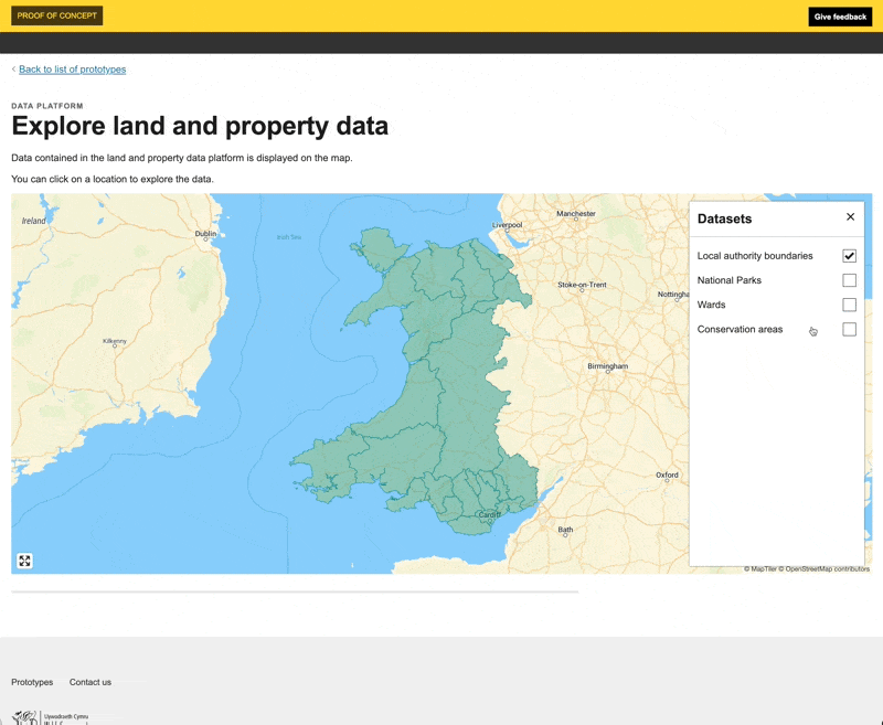
We want the platform to be as self-serve as possible. Therefore, users - service builders - need a way to discover what data the platform has. There are two main parts to that. They need to be able to know what data exists and then they need to know the shape of the data.
We ended up building a prototype where users can explore the data visually via a map. Users can turn the various layers on the map on and off, exploring what the data for each one looks like. They can also click on individual features (or multiple) and explore the shape of the underlying data records.
What we learnt
Available data lacks consistency
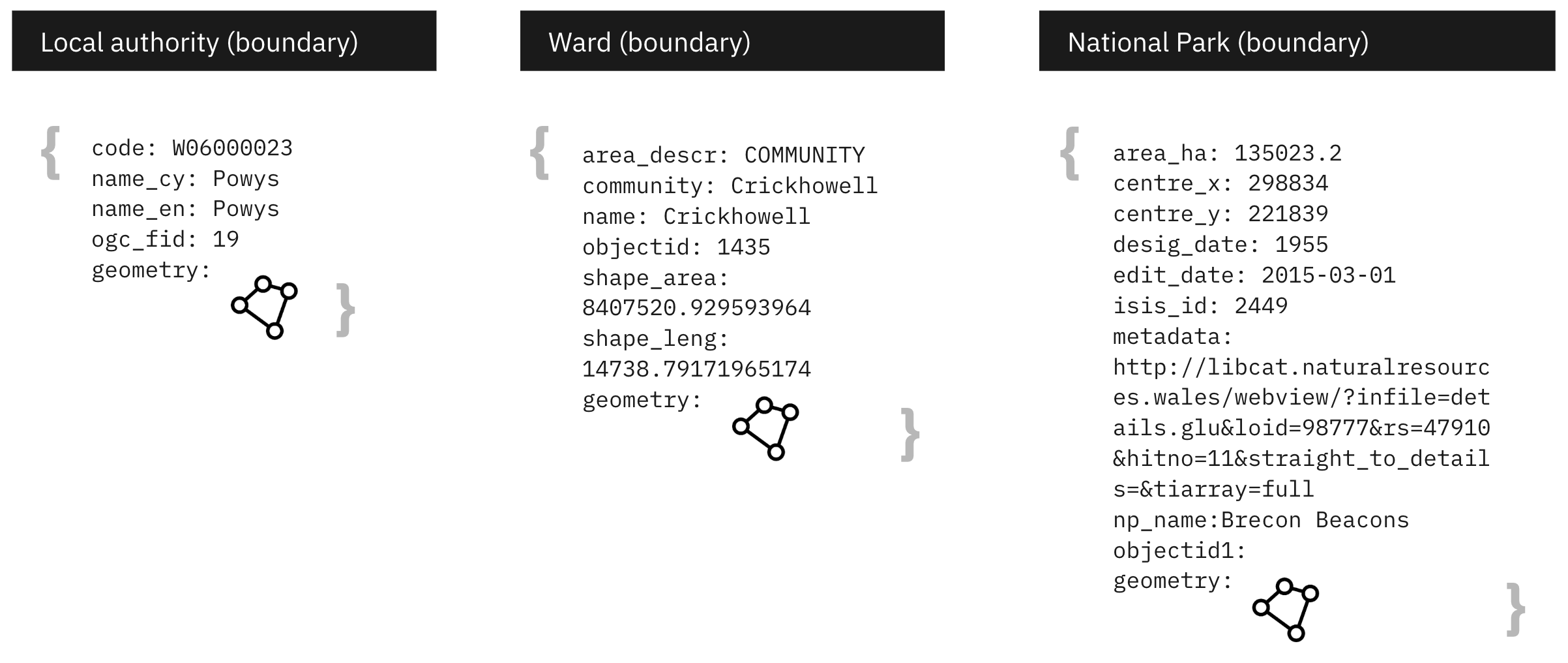
A lack of consistency in the available data makes it hard to build services. This means using open data, even from the same source (DataMapWales), is not plug and play. For example, for all the datasets we added the attribute used to provide the name of the thing the geospatial data represents is different.
Data is not always bilingual
Similarly, when it comes to providing bilingual data, it is a mixed bag. Some datasets include it, some don’t. And when they do we have the same consistency problem. Different attributes will be used for the Welsh names.
How should the platform handle large datasets
Geospatial data can be very large, which can have significant performance implications. A question we have to answer is “what is the role the platform should play in helping users manage this?”
Following standards makes it easier to integrate
Quickly integrating with the Open Street Map address service demonstrated how easy and simple it is to build on other services when you follow a common web standards approach to building services.
Issues to resolve
Service builds need to access metadata about datasets
We know that maps should always be used along with a non-map alternatives. However it is not possible for us to easily build them at the moment. To build alternatives the platform needs to expose ways of discovering what datasets it holds.
At the moment a user needs to already know a dataset exists - how do they find this out?
Then, they have to access the complete dataset to find out what it contains, see if it is complete and understand what attributes an individual record includes.
We need to provide service builders with the tools to be able to do this more easily.
Weeknotes
Each week we share a short update on what we’re learning, along with links to things we think are interesting or relevant.
Blog
- The technical architecture
- Policy challenges
- Every day's a school day – lessons learned from the land and property platform
- Why are inaccuracies creeping into addresses on the Land Transaction Tax return?
- How a map can paint a bigger picture
- Summarising the Proof of Concept
- What we learned about users
- How we used weeknotes
- What we've learned about working in the open
- What do we mean by a data platform?
- Welcome
Prototype
We built a number of prototypes to test our assumptions, platform capability and ideas.